A Babel in Landscapes
All languages are affected by the environment they are born from, they carry the landscape and temperature with them. Each particular language has variations, and through these variations a culture is expressed. We have all heard about instances of this, how there are multiple words for snow in northern climes, or how some places have different terms for shades of colors, thus making a category between light and dark blue that much more distinct. The world’s languages are the collective thoughts, myths, beliefs, ideas, dreams, and inspirations ‘brought into being by the human imagination’ and turned into sounds. It is in the fringes where we can see the drastic examples in things, and the fringes of language live in the corners of the world where old cultures have receded. Places like the swamps of Louisiana where Cajun was once spoken, Gullah in the low country Carolinas, Yiddish in New York City, and on the west coast of Ireland, there exist communities that speak Irish Gailic, or an ghaeltacht regions.
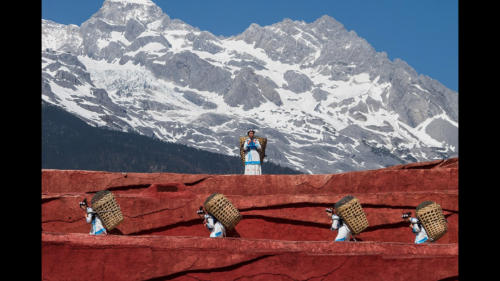
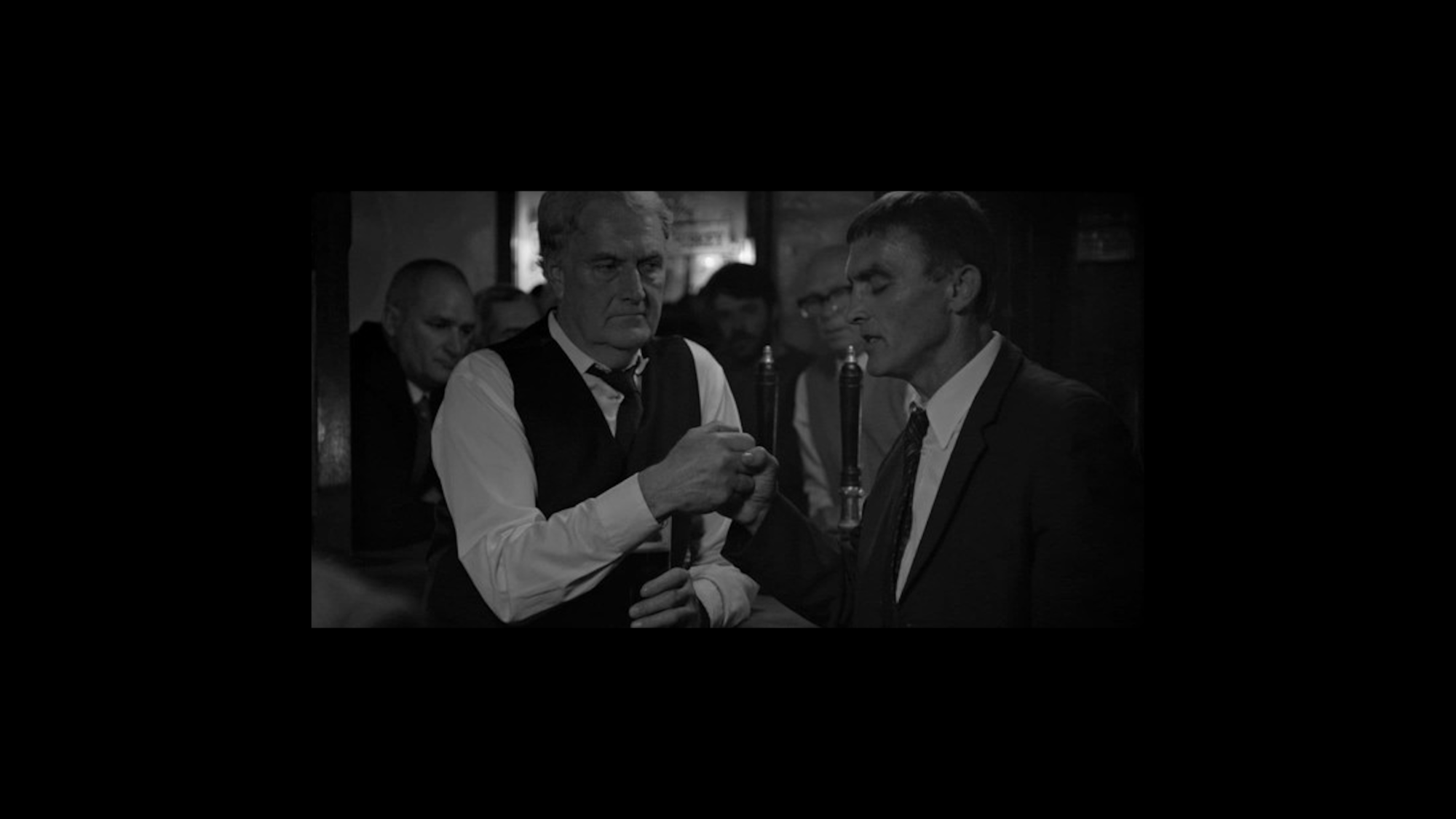
In the An ghaeltacht regions there are strange connections with an ancient world not known in the history books. The traditional song and dance here is called Sean-nós (old style; pronounced SHAN-ohss). The swell of the sea pulses through the timbre of the speech patterns; vibrations in verse and undulations. You can feel this even more magnified when in a small room with a Sean-nós singer, usually singing with no instruments, a single voice like a column of air through a room, the melody and volume come and go in waves. Sean-nós singing is done with others, at home with a room full of friends and family, or in the public houses of communities. These are songs that need others, since their purpose is to share emotions and to inspire empathy. Songs here are used to communicate pain from death of a loved one, sadness from longing, jubilation from love and birth. Watching someone sing in the Sean-nós style is like feeling a hug, it is intimate, emotive, and delicate. Which is why when performing, at times, the singer will reach out to grasp a hand from a listener. Eyes closed, accessing the emotion and memory needed to fill the room, the hand is held in direct physical connection with another, a tether to the room as if the risk of being swept and overwhelmed by the memory in the song will take them away forever, one hand in the physical, one in the metaphysical. The two hands sway and pump in a slow circular meter with the song and the swell in the air. This is called ‘hand-winding’ and the audience member involved is termed the windáil, the winder.
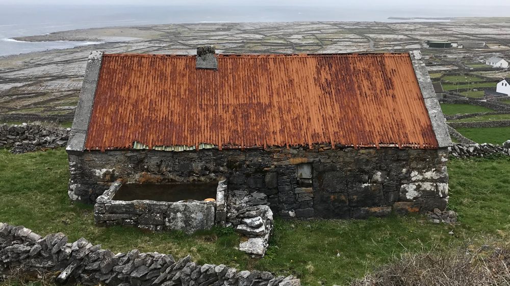
There are other physical connections with Sean-nós, with the old ways. Song is affected by landscape. The landscape of the Aran Islands (a series of three shelves elevated between Connemara and County Clare in Galway Bay peopled by Irish speakers) is made of fractals and flows, it undulates. The distinguishing geological characteristic of the Aran islands is limestone, the surrounding regions either being water or granite, hard or liquid. Limestone, however, shifts and morphs and has memory, it is temporal. Every heavy rain washes a bit away, leaving a scar, a mark of the time. In this way it is colored by the swell of the waves in the sea, as they each come crashing, imprinting the shore.
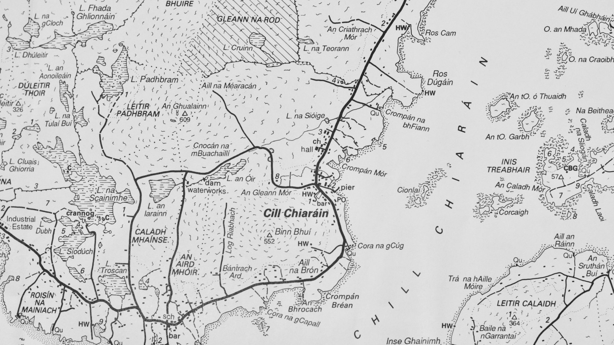
The sea and the land do the same to the language of the region. The old Irish language, still spoken here, is scarred and imprinted upon by geography, by the landscape, agriculture, and aquaculture. It is also affected by story, and emotions. Dindshenchas is a group of Irish poems from early literature that were used to teach and pass on the idea of the names of places. These texts gave a history of the geography and the telling of context, of what happened with whom in this place and hence the name given to it. It is also the Irish word for topography, the concept of emotive history and mathematical mapping merging into one. A collop is a measure of a piece of land by its grazing-ability rather than its size. Or the village Tandragee in county Armagh comes from Tóin re Gaoith which means backside of the wind (because the village is on the leeward side of a hill, protected). Or a poem used to sail into a protected harbour on one of the Aran islands encapsulates the point of view of the majority of the culture: “Mant Bead ar Ghob an Chin; Teampall Bheannain ar na Clocha Mora” (“The Little Gap on the Point of the Head: St. Benan’s church on the Big Stones”). This is used by fishermen in small boats to negotiate a shoal off the island and it gives the listener the marks to look for while in on the approach into the shoal in order not to come onto rocks and sink your vessel.
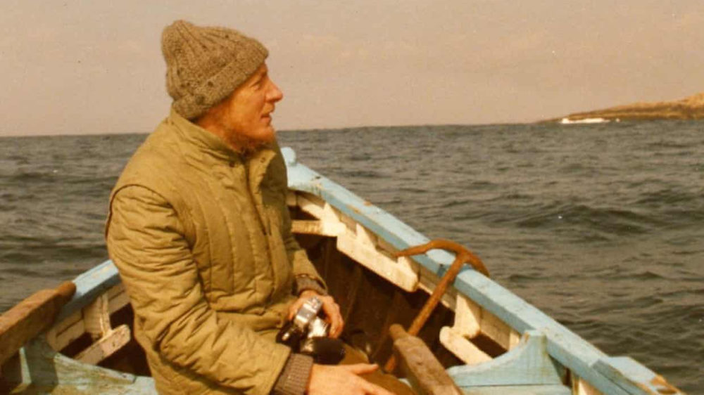
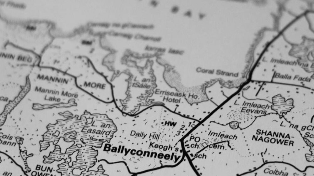
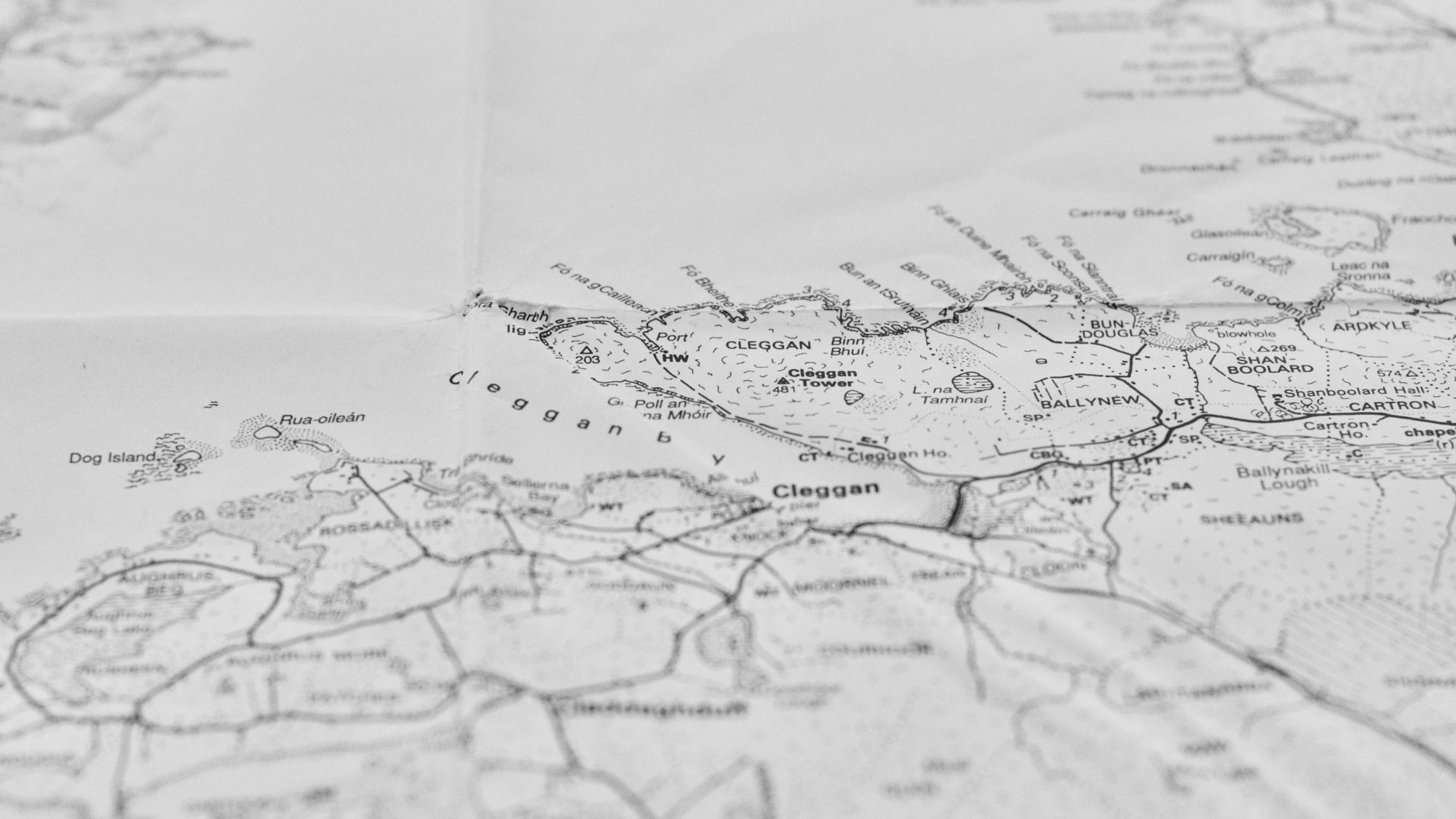
Tim Robinson came to know all of these intricacies of the Irish language, of the naming of things. Tim was originally from Yorkshire, a mathematician, at first, then, a successful artist in a time when geometric figures were in trend (there are pieces of his at the Tate museum – he went by the name Timothy Drever then). A mathematician’s mind creating beautiful scenes from fractal geometry. A life of seemingly large shifts but all on theme with mathematics, beauty, and chaos. Then, in another shift, he picked up and moved off the coast of Galway to the Aran islands. It was 1972. There he found the merging of his worlds on the shores of rock, swirling coastal lines constantly shifting with the waves and the tides. His mind wanted to know more about the landscape and he searched for maps. He found the most accurate maps made were Ordnance surveys that had been drawn by an institution not familiar with the way of Dindshenchas, the way of Irish topography, and were last updated in the early 1900’s. The maps had anglicised versions of names which carried no weight of meaning to them, no context, white noise; zero of information-content. Robinson wrote “Irish place names dry out when anglicised, like twigs snapped off from the tree,” and he became interested in mapping the landscape with all the complexities of personal history of a community. This was no easy task as he was not from there, but ever committed, Tim started to walk, and talk, and mostly listen and then began marking notes on a page. It became a new art piece that was to last over 40 years. He produced hand drawn maps of the Aran Isles, the Burren, and Connemara; but single map sheets not being enough to tell the stories of the places, he also wrote page after page about the mapping and stories of the landscape, translating what he was hearing in the homes and pubs of the countryside. These writings became a series of books on the region; two books on the Aran Islands, and three on Connemara. Together with the physical maps he drew, one would have the topography as well as the context of communal history. Tim’s writing was an attempt to lock in the language of the place in the naming of things. Place names locals used were beginning to be lost, and in the names were the understanding of time and space of the landscape, was the landscape itself in the tempo and cadence of the words.
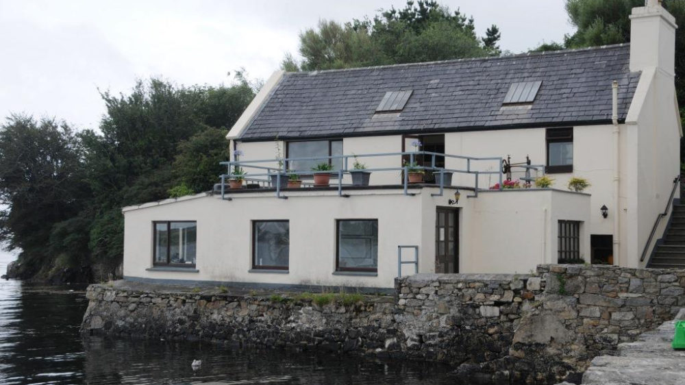
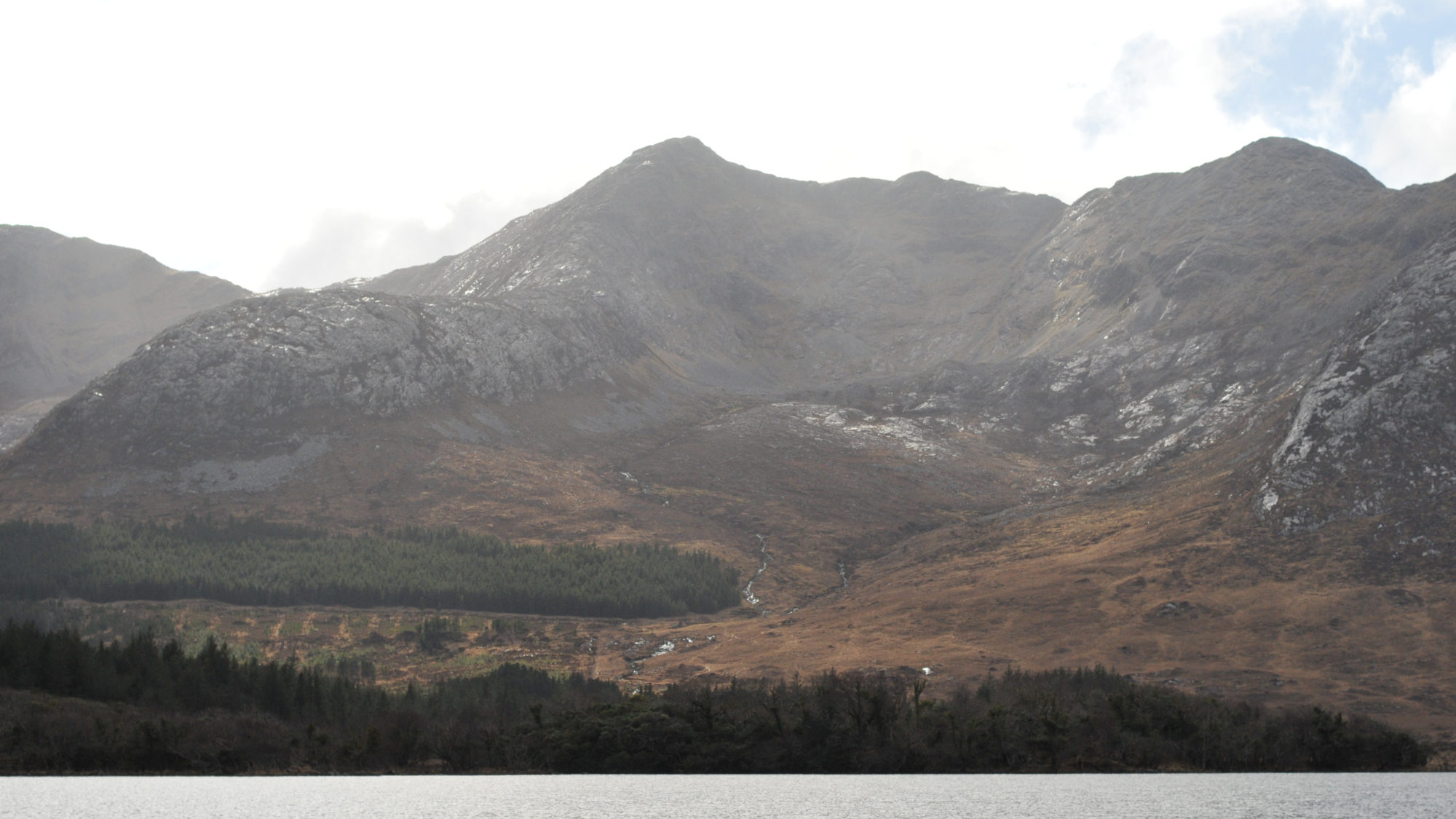
I first met Tim in 2008 when I would come into his home in Roundstone (a village in southern Connemara) to purchase his maps as gifts for travelers I was guiding on cycling trips through the region. I would usually buy a whole season’s worth which was a large box of maps and books, then we would sit and have tea and talk about travel, math, and philosophy. He had a publishing business named Folding Landscapes and by that time he had created three maps and written two books on his life in the Aran islands, and had just published his first of a trilogy on life in Connemara. His office, and house were the same chunk of land at the end of a tip of a jetty, fish-hooked around a small inlet looking back at the twelve peaks of Connemara. The region is defined by some as any place you can see these twelve peaks, also known as the Twelve Bens, and a hell of a view it was. I would sit in ignorance of what Tim was doing; only years later did I delve into his works past the aesthetic of his map making. There were phrases that Tim would say, that months later would resurface and begin to grow into an understanding. I don’t think he did this on purpose, I think he had just been so practiced at living, thinking, and listening to his surroundings in such a way, an Irish way, a Sean-nos way, that he couldn’t help but share depth, it was built into his language.
When a language and a culture have the correct ratio of depth and understanding of self, of absorbing a gathered past into its own tool used for talking about the present and future, there is a slow, seeping, almost collective consciousness it can attain. Roots, a community, wisdom. Wade Davis talks about this in his concept of an ethnosphere, the collective ideas and dreams of humans, and every “language is an old growth forest of the mind.”
There is a suspension of time and space with a language and song like this, the past enveloped in the present and future. In single place names one can understand the reason why the village is there, who built it, and when, just by speaking the name. A beautiful mathematical linguistic formula. A kabbalah of cartography. Not all languages hold this magic formula, and it might just be me, but it seems like the old languages of planet earth were much more connected to landscape than they are now. Something along the way has been broken, or misplaced, a priority perhaps, some empathy. We can feel this in the digitalization of life and the speed of motion in travel. You can walk into a flying metal tube that transports you to the other side of the world in a day without smelling, touching, hearing any of the landscape in between. Of course we have skimmed down on the language needed to describe things like this, we no longer experience it slowly, methodically, over time like we would have before phones, planes, and apps. I think this is what drew Tim to the west coast of Ireland, and it certainly is what draws me there.
It is a stark landscape if you glance at it, but it is detailed and intricate if your glance goes to gaze, and time is needed for this transformation, time for your eyes to go past the initial.
Tim talked about where the land meets the water, about how it could look like a small distance on a map, but if you walk the shore from one point to another on the coast, following the water line, what is 1 kilometer apart on paper could be 30 kilometers of coast by the time you unfold every bay, nook, and estuary on a slow walk. I think we forget this in our own backyards; the routines we have in our landscape are by no means the limits of the land, and in learning how to look past our habits we can discover new things about our environments, new ideas about our space and time.
This is what a language like old Irish teaches, the value of context and the singularity of past, present and future all in the naming of a place.
It makes all the sense in the world to me now why a Sean-nós singer, deep in song, grasps at the crowd searching for a windáil, a tether, an anchor, eyes closed, tranced and singing the histories and emotions of a people. If they didn’t, they might disappear altogether, out, and into, the ether.
Tyler likes his fare share of musical trances and loves to jive on strange languages in the dark corners, email him before he dips too far into the ether and disappears altogether.